
The hydrographic map of Europe has very important rivers that have played various roles throughout the history of civilization. Among other things, because human and animal life revolves around access to water, the most precious asset among living beings. Today we will navigate through the main rivers of europe. In addition, in addition to knowing the longest and mightiest river in Europe, you will also know the details of where it passes until it reaches the sea.
For this reason, we are going to dedicate this article to tell you about the main rivers in Europe, their characteristics and importance.
Rivers of Europe
The current hydrological network of the European continent is the result of the last ice age. This process it originated in what are now fjords, lakes, and large river basins. Rivers flow through soft material and mix with areas of hard material. The faults and the joints are in charge of guiding the course of the river. As far as Europe is concerned, its rivers are not very long and their courses are relatively regular.
Danube river
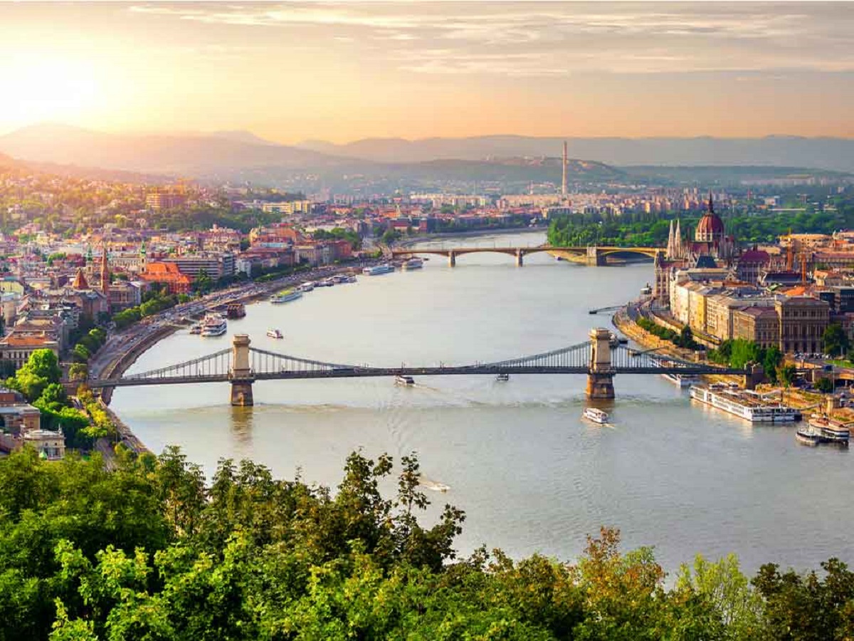
The Danube River in Germany originates in the Black Forest of Germany and its mighty course crosses more than a dozen countries in Central and Eastern Europe, crosses four major European capitals and ends at the Romanian Black Sea, which forms a delta.
Its main river, the Black Forest, is located in Germany, especially in the mountains that are currently listed as tourist destinations. There is the Feldberg peak at an altitude of 1493 meters.
Due to the characteristics we have, it is almost a navigable river. From Ulm in Germany, there are many tributaries that connect important agricultural areas. Its flow is in accordance with its basin. Even so, it is no more navigable in terms of traffic than the Rhine, another major river in Europe. Considering the number of countries it runs through, each with their own language name and their occupied capitals, we can infer the range of importance for this European river. Among the highlights are its waterways, which serve as international bridges for agricultural, fishing, tourist, commercial and industrial activities.
Rin River

The Rhine is a body of water located in European territory. It originates from the canton of Graubünden in the Swiss Alps and flows into the North Sea through a 1.230 kilometer path. The water flows in a north-northwest direction, out of a hydrological basin of approximately 185.000 km2. Its average displacement is 2.900 m3/s. It is fed by other smaller rivers such as the Tamina, Medel, Neckar, Moselle, Ruhr and Lahn.
Lake Thoma is considered the official source of the river, but it was not until the confluence of the Pre-Rhine and the Rear-Rhine that it began to be called the Rhine. Shortly after its confluence, the Rhine flows through the alpine glacial valley, the Rhine Valley. from the Rhine. The land gradually leveled out, the water fed into Lake Constance, and then moved west. In the north of Switzerland, fall about 23 meters high to form the Rhine Falls and continue to the sea. Near here, it joins the Meuse and the Scheldt to form a delta with numerous channels.
From the lake to the sea, the Rhine passes through Switzerland, Liechtenstein, Austria, Germany, France and the Netherlands, passing through Basel, Mainz, Dusseldorf, Strasbourg, Cologne, Vaduz, Arnhem and major cities such as Rotterdam. It is divided into 4 main parts: the Upper Rhine, from Lake Constance to Basel; the Upper Rhine, between the German cities of Basel and Bingen; the Middle Rhine, between Bingen and Cologne/Bonn; the Lower Rhine at Cologne/Bonn and continues to form a delta.
Seine river

The Seine is a European watercourse on the Atlantic coast, in northern France. His birthplace is in the Langres plateau at an altitude of about 470 meters, near Dijon, in the Côte d'Or department, and runs northwest through the cities of Troyes, Fontainebleau, Paris, and Rouen until it reaches Its estuary is in the Broad Estuary, between Le Havre and Honfleur, northwest , in the bay of the Seine in the English Channel
The Seine is the second longest river in the country after the Rhône (although part of it runs through Swiss territory), with 776 km. Its basin is 78.650 square kilometres, most of which is within the Bassin parissien or Parisian basin. Geologically it is basically a basin-like shaped sedimentary basin, open to the English Channel and the Atlantic Ocean.
The basin consists of geological formations that extend along steep slopes that converge towards the center, with important aquifer formations interposed between them. Its terrain generally does not exceed 300 meters, except on the south-eastern edge at the height of Morvan, where the highest point is 900 meters.
Volga River
The Volga is the longest river in Europe. It originated in western Russia and flows through western Russia. It is known as the national river of Russia. With a length of 3.700 km and an average flow of 8.000 m3/s, it is also the first of its kind in Europe. During May-June its flow increases due to spring thaw, increasing the risk of major flooding.
A series of canals connect the river with the Baltic Sea (Volga-Baltic Canal), the Don, the Azov Sea, and the Black Sea (Volga-Don Canal), as well as with Moscow. The great river is like a tree because of its flow. Numerous rivers, streams, and other streams drain their waters into the Volga. The river passes more than 250 cubic kilometers of water each year. For natural reasons, the river is divided into three parts, one part from the source to the mouth of the Oka River is called the Upper Volga, the other part flows into the Kama River and is called the Middle Volga, and the Samaraluka River is called the Lower Volga.
Thames River
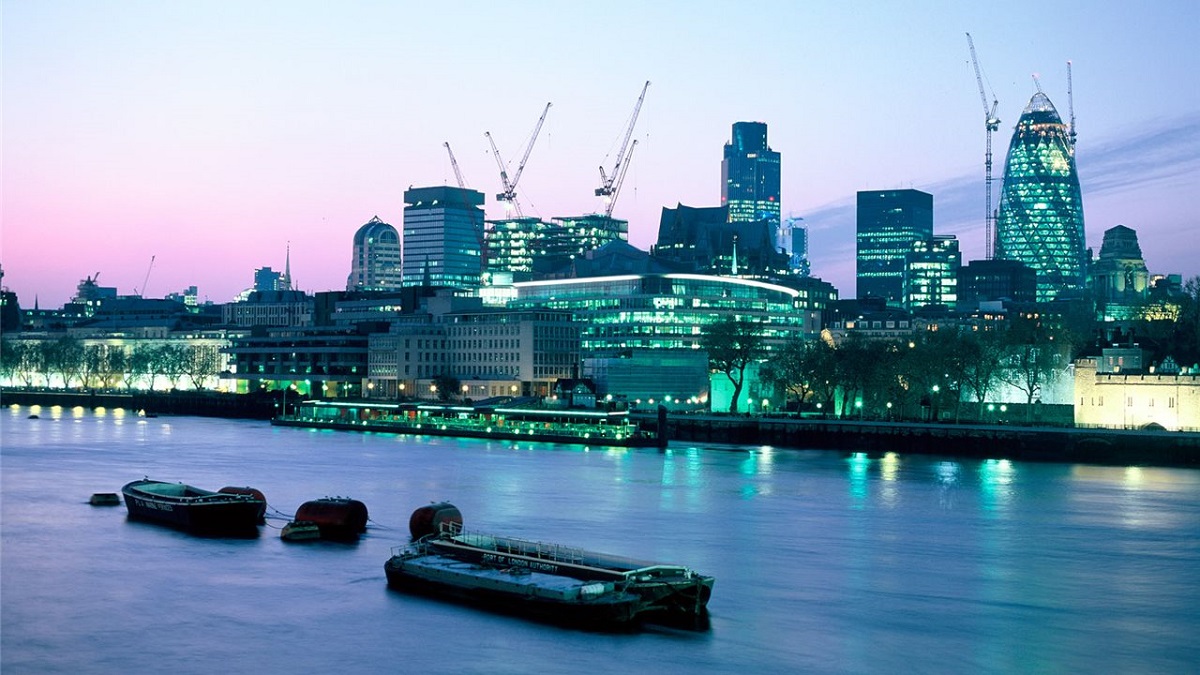
The Thames, also known in some places as the River Isis, is a river that flows through the south of England, including London. At 346 kilometers long, it is the longest river in England and the second longest in the UK after the Severn. It flows through Oxford (where it is known as Isis), Reading, Henley upon Thames and Windsor. The lower reaches of the river are known as the Tideway, after its long tidal stretch to Teddington Lock.
It rises from the headwaters of the Thames in Gloucestershire and empties into the North Sea through the Thames estuary. The Thames drains all of Greater London. Its tidal section extends to Teddington Lock, includes most of its London leg and has 7m ascents and descents. Considering its length and width, the Thames has a low flow. Despite its smaller basin size, the Severn's average discharge is nearly double.
I hope that with this information you can learn more about the rivers of Europe and their characteristics.